Pirate culture
Custom, symbol, and story
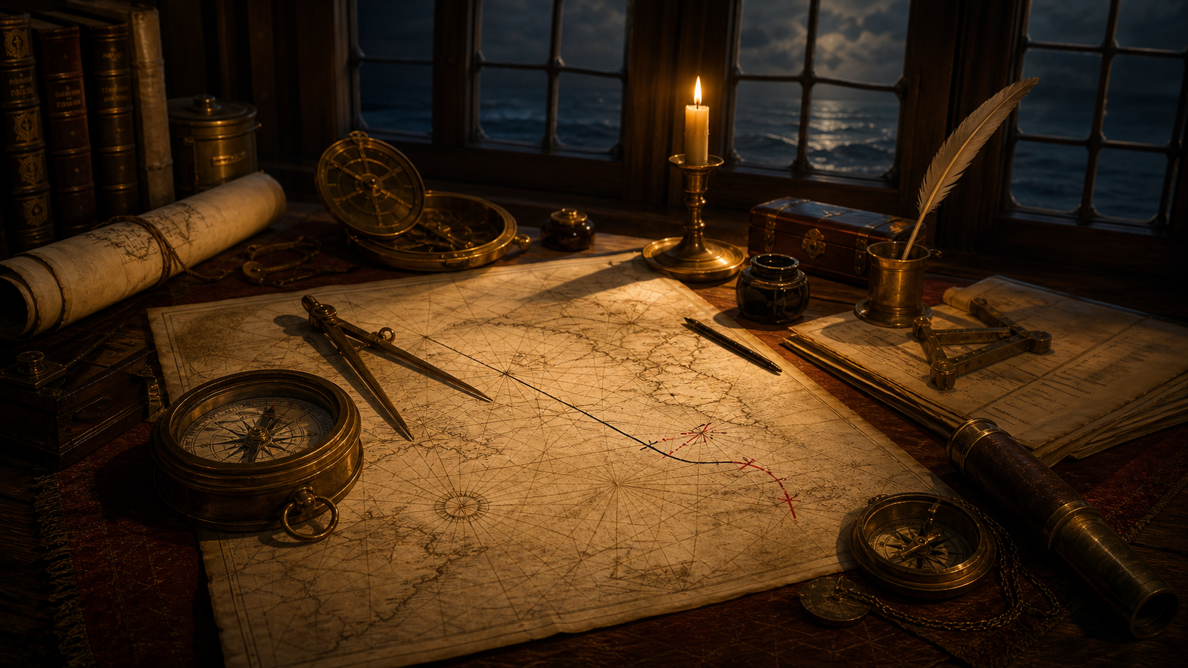
Pirate navigation relied on charts, pilots, dead reckoning, landmarks, currents, soundings, and practical seamanship more than treasure maps.
Pirates did not find ships by smelling treasure through the fog.
They navigated the same hard ocean as everyone else: badly charted coasts, uncertain winds, shallow inlets, storms that arrived like unpaid debts, and maps that could be useful without being especially forgiving. The pirate of fiction unfolds a parchment, follows a dotted line, and arrives at an island shaped suspiciously like destiny.
The real sailor had a less cooperative workplace.
Pirate navigation was practical seamanship turned predatory. A pirate did not need to know every ocean. He needed to know where trade moved, where ships slowed, where harbors opened, where shoals waited, where patrols were weak, and where a stolen cargo might be sold without too many questions.
The map was never the whole trick.
The trick was knowing what the map did not know.
The map was a tool, not a spell
A chart could be valuable, but no chart made a poor sailor safe.
Early modern charts varied in quality. Some coastlines were drawn well enough to be useful. Others were incomplete, copied from older work, or dangerous when treated with too much confidence. A chart might show a bay, a headland, a channel, or a sandbar. It did not remove weather, darkness, currents, panic, or the problem of being chased by someone with cannon.
Pirates could steal charts, logbooks, sailing directions, and pilots along with cargo. A captured merchant captain’s papers might reveal routes, ports, cargo expectations, or hazards. A captured pilot could be worth more than a pretty chest if he knew the local water.
That is the part the treasure-map myth usually misses.
Pirates were not only stealing things. They were stealing knowledge.
A sack of coins could be spent once. A good route could be used again. A pilot who knew a channel through shoals could make the difference between escape and wreck. A logbook could reveal habits. And commerce, despite all its flags and ledgers, was full of habits.
Pirates hunted those habits.
Latitude was easier than longitude
Sailors could estimate latitude with instruments and celestial observation, though accuracy depended on skill, weather, and equipment. Longitude was harder before reliable marine chronometers changed navigation in the eighteenth century.
That meant voyages often relied on dead reckoning: estimating position by course, speed, time, and drift. The method was useful. The name remains rude.
Dead reckoning could work well over short stretches or when corrected by landfalls and observations. It could also accumulate errors. A little mistake in speed, current, or direction could become a large mistake after days at sea. The ocean is very patient with arithmetic errors. It simply waits until land appears in the wrong place.
Pirates used these same methods because many pirates had been ordinary sailors, privateers, naval men, pilots, or merchant seamen before turning outlaw. Piracy was not an escape from maritime skill. It was maritime skill used against trade.
A pirate captain who could not navigate was not romantic.
He was a danger to his own crew.
Coastlines mattered more than X marks the spot
Near land, sailors watched everything.
They used leads and soundings to judge depth and seabed. They studied the color of water, the shape of surf, birds, headlands, currents, islands, reefs, and familiar approaches. They learned where a vessel could hide, where a larger warship could not follow, and where a prize might be trapped before it reached safety.
This local knowledge mattered especially in places like the Caribbean, the Bahamas, the Carolinas, Madagascar, and the many inlets and channels where a shallow-draft vessel could slip away from a heavier pursuer.
A map could show a coast.
A skilled sailor knew how that coast behaved when the wind turned foul.
That is why pirates often operated near routes, islands, straits, harbor mouths, and coastal choke points. The open sea looks free on a wall map. Trade made it less free. Ships followed winds, seasons, currents, and commercial routines. They needed water, repairs, convoy routes, ports, and predictable passages.
A pirate did not have to own the sea.
He only had to wait where the sea narrowed into opportunity.
The real treasure map was traffic
Pirate fiction loves the map to buried gold because it gives the story a clean destination.
Real pirates were often more interested in living maps of movement: where the Spanish treasure fleets sailed, where merchant ships left port, where slavers crossed the Atlantic, where pilgrims and cargo moved through the Indian Ocean, where coastal traders hugged land, where naval patrols were late, and where officials could be bribed, fooled, or avoided.
The most useful map might be a sailor’s memory, a rumor from a tavern, a captured paper, or a pilot’s knowledge of a channel.
Trade routes were not abstract lines. They were habits made of wind, money, and fear. A pirate who understood those habits could appear where a merchant captain least wanted him and most expected trouble.
That is the darker truth behind pirate navigation.
It was not about finding treasure after the crime.
It was about finding the victim before it.
Weather still had the final vote
No amount of navigation made the sea obedient.
Storms wrecked pirate ships. Shoals caught them. Currents carried them wrong. Bad weather scattered fleets, spoiled chases, and turned confident plans into debris. The Whydah wreck off Cape Cod is a famous reminder that a rich pirate career could end in one night because wind and water did not care about reputation.
Blackbeard’s Queen Anne’s Revenge grounded near Beaufort Inlet. Other pirate vessels were lost, abandoned, burned, captured, or broken by the same conditions that threatened every ship. Pirates could exploit dangerous geography, but dangerous geography did not become loyal because they flew a black flag.
The sea was useful.
It was not on anyone’s side.
Why pirate maps became magical anyway
Treasure maps survive because they do something history does not always do: they point.
They make a story simple. Here is the map. Here is the island. Here is the X. Dig here. Become rich. Try not to be cursed.
Real navigation asks the reader to think about wind, labor, instruments, pilots, shallow water, commerce, stolen information, and the mathematics of not dying in the wrong place. That is more interesting, but it is less tidy.
The movie map gives the audience a quest.
The historical map gives the crew a chance.
Pirates did use charts. They did use routes. They did use pilots, memory, papers, coastlines, soundings, and local knowledge. They just did not usually leave behind convenient treasure diagrams for future children, archaeologists, and suspiciously lucky innkeepers.
The better truth
Pirate navigation was not magic.
It was trade knowledge, ship handling, stolen information, weather sense, dead reckoning, coastal memory, and nerve under pressure. It was the ability to know where a ship might be, where it might run, where it might surrender, and where the pirate vessel could disappear afterward.
The pirate map in fiction tells you where the treasure is buried.
The real pirate map told you where the next ship would have to pass.


